FDF
Code
About
3D wireframe rendering application that transforms 2D elevation maps into 3d landscapes,
creating a wireframe representation of the terrain.
using the school graphic library Minilibx
Examples
- simple file format
0  0  0  0  0  0  0  0  0  0  0  0  0  0  0  0  0  0  0
0  0  0  0  0  0  0  0  0  0  0  0  0  0  0  0  0  0  0
0  0 10 10  0  0 10 10  0  0  0 10 10 10 10 10  0  0  0
0  0 10 10  0  0 10 10  0  0  0  0  0  0  0 10 10  0  0
0  0 10 10  0  0 10 10  0  0  0  0  0  0  0 10 10  0  0
0  0 10 10 10 10 10 10  0  0  0  0 10 10 10 10  0  0  0
0  0  0 10 10 10 10 10  0  0  0 10 10  0  0  0  0  0  0
0  0  0  0  0  0 10 10  0  0  0 10 10  0  0  0  0  0  0
0  0  0  0  0  0 10 10  0  0  0 10 10 10 10  0  0  0  0
0  0  0  0  0  0  0  0  0  0  0  0  0  0  0  0  0  0  0
0  0  0  0  0  0  0  0  0  0  0  0  0  0  0  0  0  0  0
results in
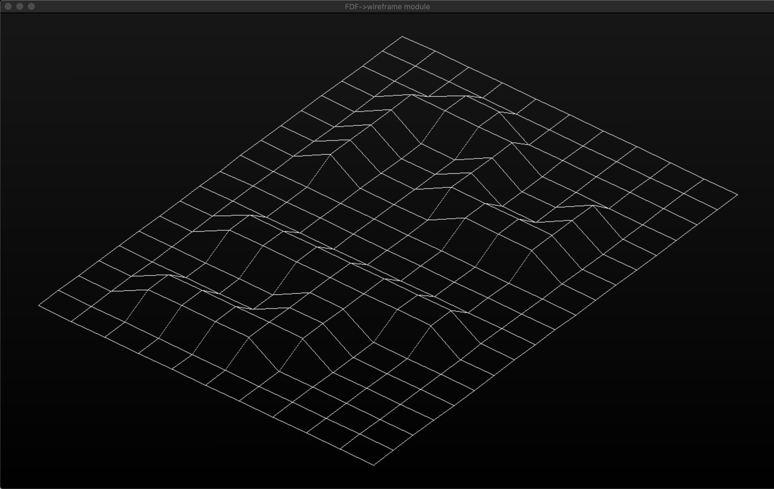
different heights
maps/old_maps/10-2.fdf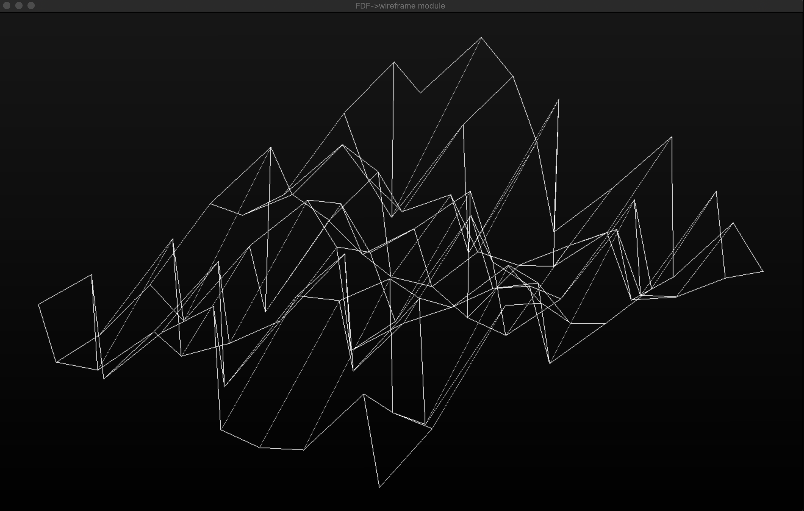
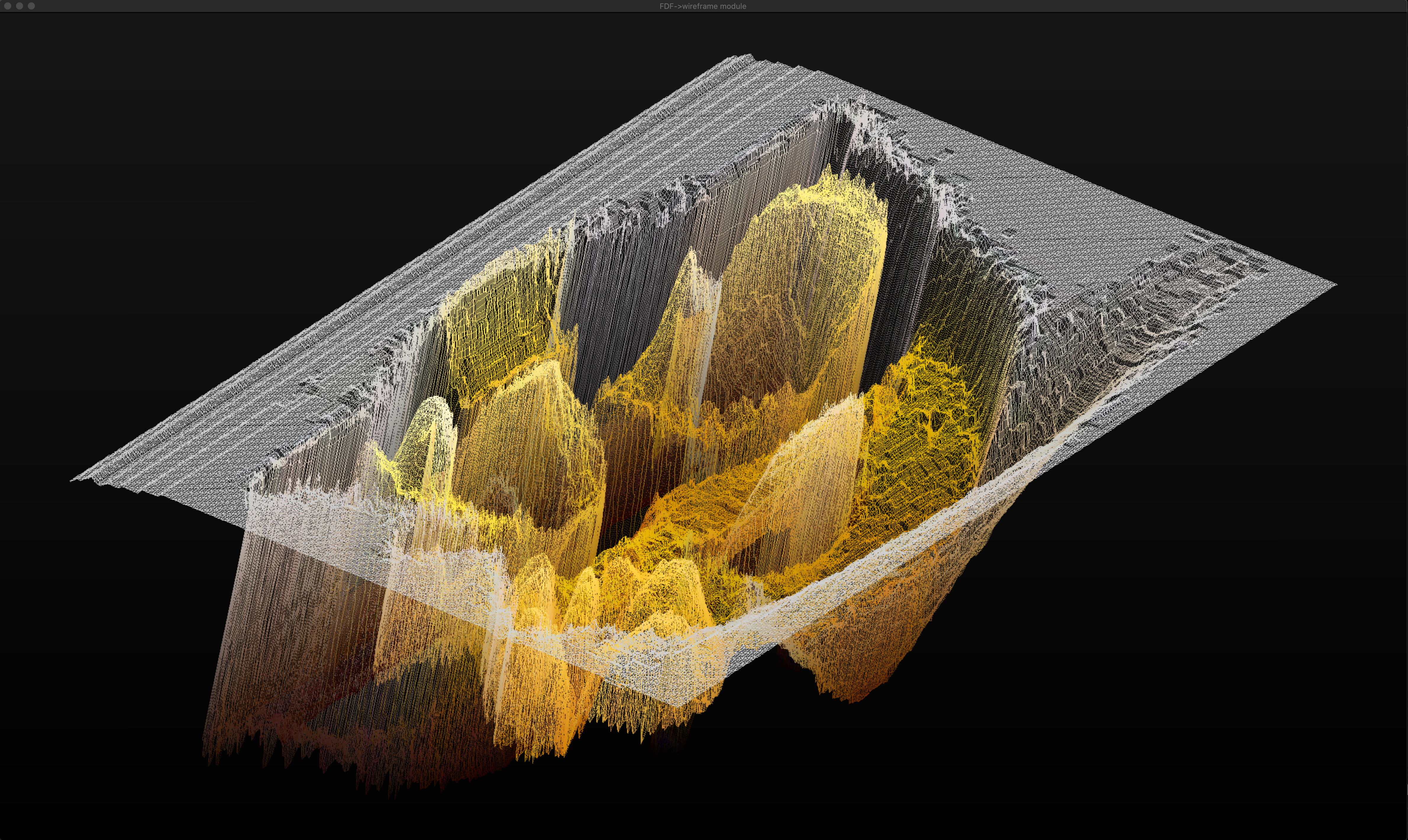
bigger map
maps/new_maps/MGDS_CORDILLERA_DE_LOS_ANDES_OCEAN0_S.fdf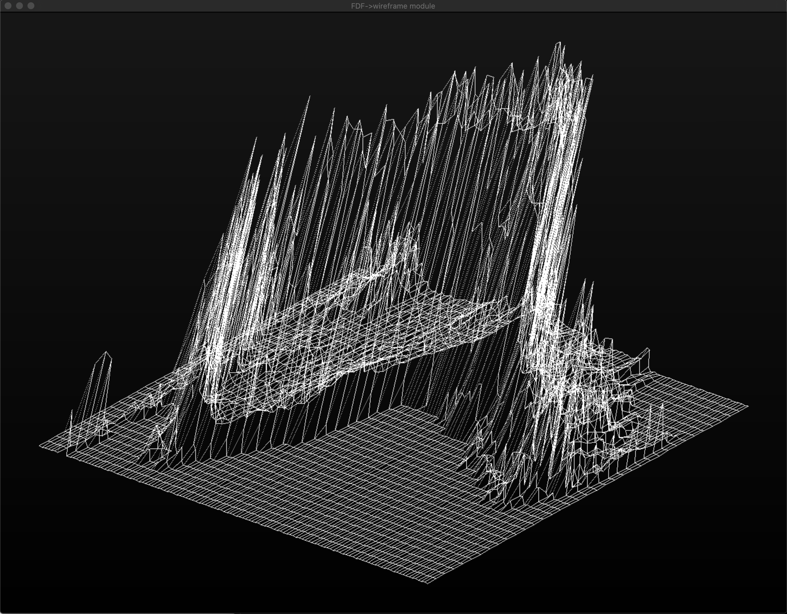
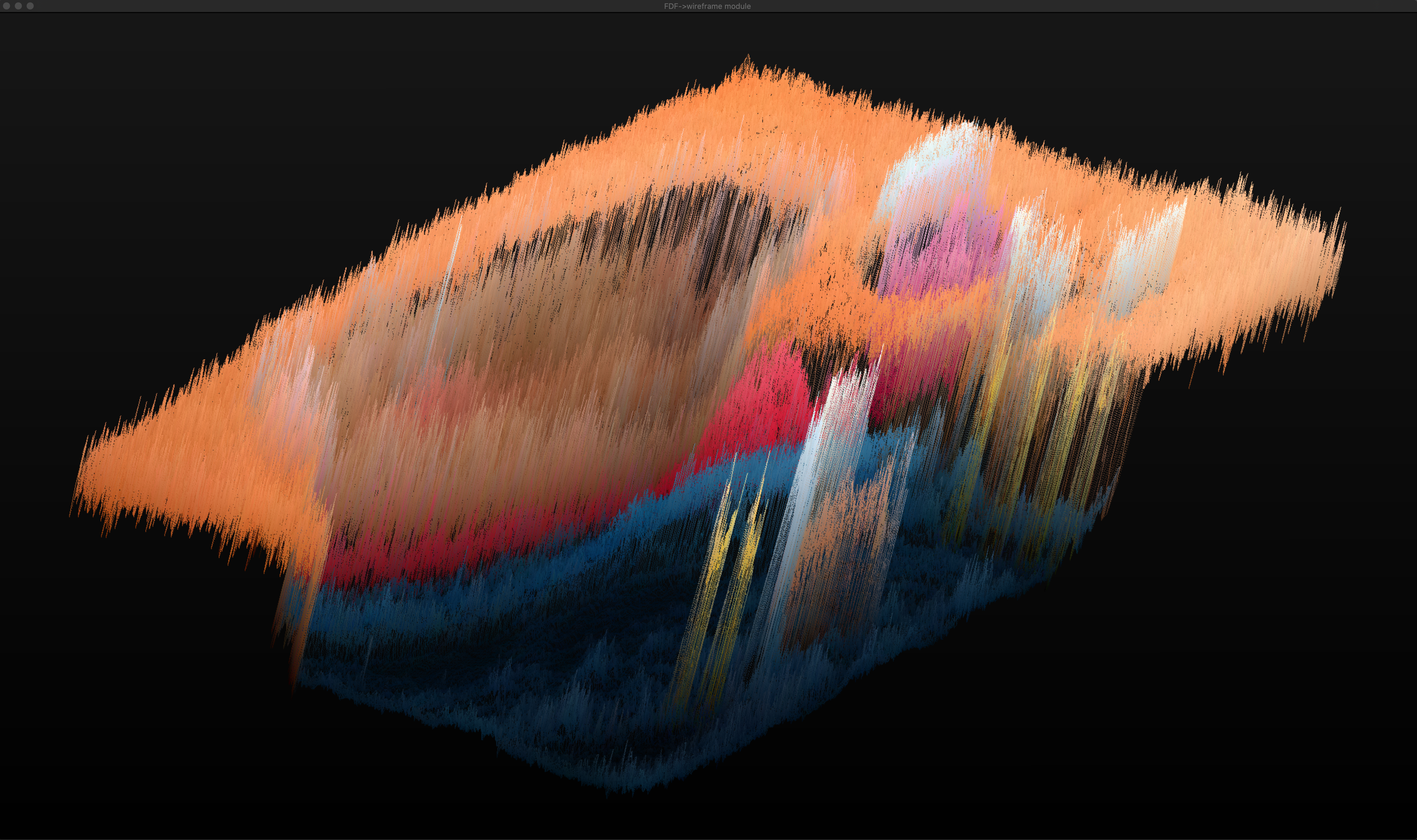
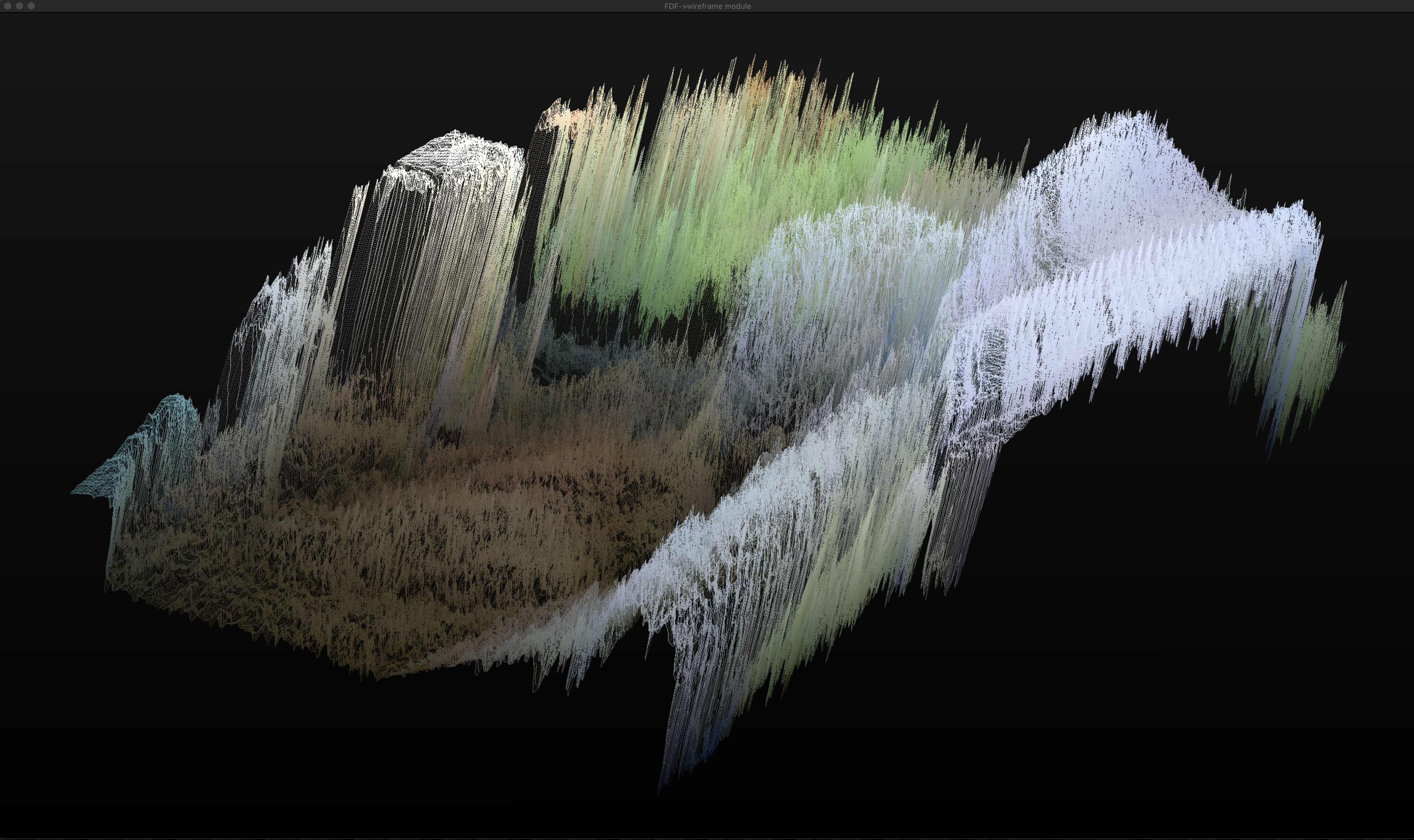
complex maps
maps/new_maps/nerd_colored.fdf
maps/new_maps/hydrochoerus_hydrochaeris_2.0.fdf
maps/new_maps/hydrochoerus_hydrochaeris.fdf